Azimuth and distance project
Hello Everyone!,
About the Project
This project is geared more for the high school level math student.
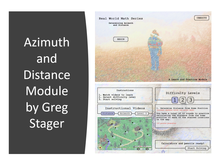
The premise of the project is that of introduction and practice but in a way that subtly provides the student with a potential real-world scenario. I mean… Have you ever heard or asked the question yourself… “Why do I have to learn this? Where could I ever use this?” This module will apply the Pythagorean Theorem as a means of calculating the straight line distance between two points on a map and will use a trigonometric function called the Tangent as a way of calculating the degree of travel known as the azimuth. Basic land navigation courses might require you to determine the straight line walking distance to each of the waypoints on your route and what azimuth you would need to follow with your compass.
Project Features
- Selectable embedded videos with information about each required calculation.
- Three levels of difficulty.
- Score keeping for each of the three levels.
- Level 3 offers random start and end positions for increased variety, answers, and practice.
- Rotating knobs for use in dialing in on the specific coordinates for each location on the map.
- Answer entry block is cleared between each practice problem.
- Azimuth between your two points is shown.
- The X and Y axis will animate to the designated location when you’ve locked on to the right coordinates.
- Your location (star) is tracked and displayed to show X and Y coordinate postion.
- A total of 10 rounds on each level.
Special Option
I suppose if you were in this class you might be asked to post a screenshot proof of your success on level three. Can anyone get a perfect score of 50 points? Of course – you may do it as many times as necessary to get that perfect 50! #aimingForMastery
Tip
**Funny thing is that level three is randomized but I am surprised at how often the same combinations come up. Just be sure to pay careful attention at which direction you are traveling. The distance may be the same but azimuth from Home to Point 1 is different than the azimuth from Point 1 to Home.
Enjoy!
You must be logged in to post a comment.
- Most Recent
- Most Relevant
Hi Greg,
Thank you for submitting this project. I spent a lot of time on this project and could only imagine how much time and effort you would have spent in creating it. It took me some time to go through the videos first to understand the concepts to solve the problems. The only issue that I faced and other users might also agree was the difficulty in placing the stars exactly on the allotted pixels. If you could explore some snap to grid or some other options for this process then it’d really improve the user experience of this project. Once again, thank you for contributing such a wonderful project! Can’t wait to see more such exciting projects from you
Thanks Ishan.
Yes – I agree with the movement of the stars and really did want to work out something slightly different for that along with a little more story behind each point on the map such as having some sort of landmark worth visiting and learning about when you got there. I simply did not have enough time to work those pieces in.
I see this as the sort of project that would be appropriate as a follow up activity to a more formal lesson from an instructor but does have the ability to stand alone.


 Download Project


