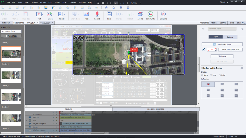
This interaction is one element from a complex software simulation, developed in Captivate. The software is used for planning flight patterns for drones. In this example, learners can select one specific waypoint and then zoom in/out on a map.
The map element was created with custom states.

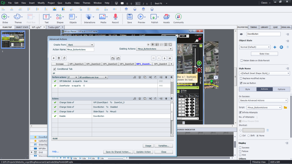
The +/- buttons execute conditional actions that change the state of the image object, change the state of the zoom indicator and enable/disable the zoom buttons.

Note: In this example, only one waypoint (#1) is enabled. In the full simulation, learners can select from several waypoints and also “play back” a flight pattern.
This interaction is one element from a complex software simulation, developed in Captivate. The software is used for planning flight patterns for drones. In this example, learners can select one specific waypoint and then zoom in/out on a map.
The map element was created with custom states.

The +/- buttons execute conditional actions that change the state of the image object, change the state of the zoom indicator and enable/disable the zoom buttons.

Note: In this example, only one waypoint (#1) is enabled. In the full simulation, learners can select from several waypoints and also “play back” a flight pattern.
You must be logged in to post a comment.
- Most Recent
- Most Relevant
I see. Captivate offers kind of simplicity (though it isn’t THAT simple) at the expense of complexity. Still, I appreciate the looks of your project. It is really impressive. I also noticed the zooming script. I also invented this kind of action but I can see yours is more complex.


